GEODATA - This is our expertise!
Together with the Aerial Imagery Service the photogrammetric generation and the application-oriented processing of Geo Basis Data and Geographic User's Data are the main focus of GTA GeoService GmbH.
Various Complete Solutions for presenting and working with the geographic data round off our service offering.
Our Services include:
- Aerial Imagery:
- Image Flights for capturing nadir and oblique imagery,
- Scan Service for existing analogue imagery,
- Aerotriangulation ...,
- Geo Basis Data:
- Orthophotos and Aerial Maps,
- Topographic Maps,
- 3D Terrain Models derived from aerial images or laser scan data,
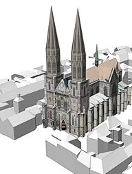
- 3D City Models and 3D Landmarks in various Levels of Detail,
- Geographic User's Data:
- Green Areas Cadastre,
- Real Estate Management including outdoor facilities,
- Solar Potential Assessments based on 3D models or laser scan data,
- Street Cadastre,
- Sealed Urban Areas Cadastre.
- WebGIS Solutions / Geoportals for visualization and analysis of geographical data.
- Software for Dynamic Urban Planning and Simulation
- visualization of existing and planned buildings, streets, green, trees and street furniture
- simulation of traffic flow
- simulation of human flow
- simulation of scenarios relevant for homeland security
- weather simulation
- lighting simulation

Our expertise for your projects
We gladly advise you project-specific and customer-oriented. Ask for a quote for your project without any obligation. Write us an email.